San Antonio could end 2020 with thunderstorms, possible hail

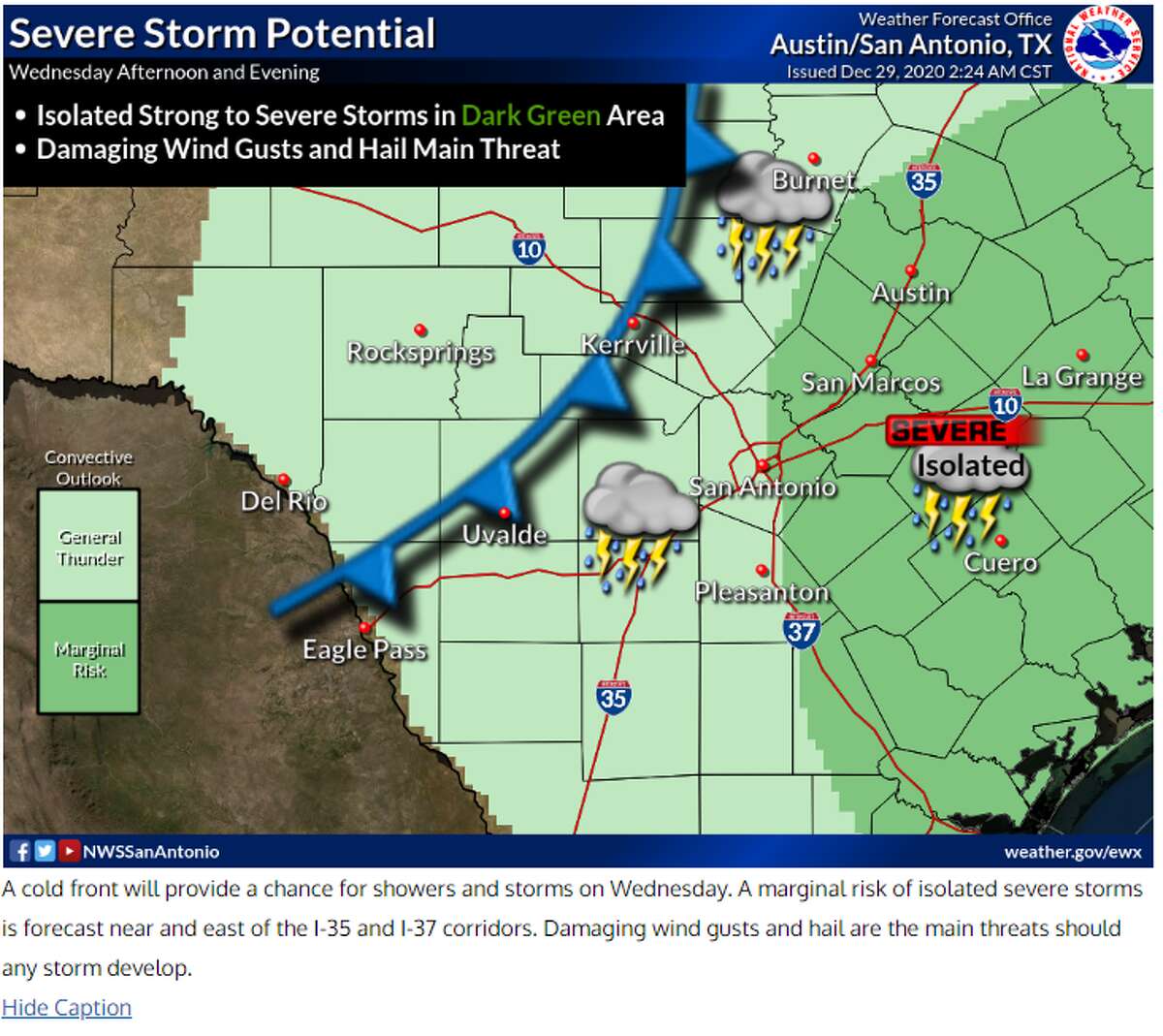

San Antonians better brace for the next cold front coming on Wednesday afternoon that will bring a chance for severe weather with possible hail and gusty winds.
Wednesday (High 68 and Low 38): Clouds will start the day with the front scheduled to move through the area late afternoon bringing a 40 percent chance of rain to San Antonio. Along the front there will be thunderstorms with the potential for some stronger storms to bring hail of 1 inch and gusty winds. Overnight rain will continue with some isolated areas of heavy downpours. Chances for severe storms are low at this moment but can’t be ruled out for San Antonio.
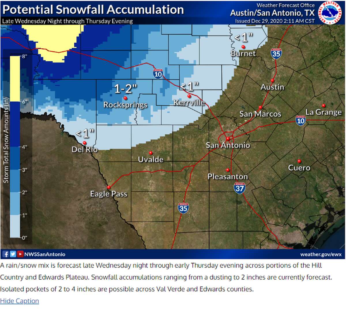
New Year’s Eve (High 50 and Low 34): San Antonio will wake up to more widespread rainfall and thunderstorms with a 70 percent chance of rain. However, the Hill Country areas such as Kerrville and Fredericksburg are expecting more of a snow/rain mix. San Antonio temperatures are still too warm for any snow to develop from this system. San Antonio could see rainfall totals around 1-2 inches from Wednesday and Thursday. The evening will bring clear skies, but still cold and breezy with north winds as we get closer to midnight to ring in the new year.
Teresa Velasco is a digital producer for mySA and the San Antonio Express-News. She has a bachelor’s degree in broadcast meteorology. She uses data provided by the National Center for Atmospheric Research, the National Oceanic and Atmospheric Administration and others for her forecasts.