FORECAST HIGHLIGHTS
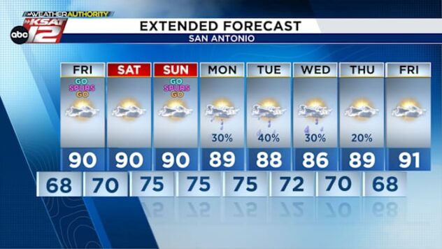
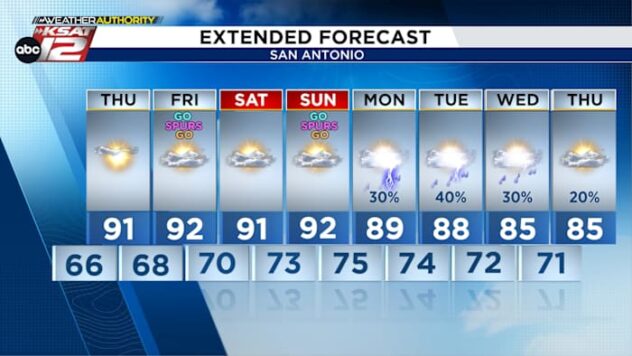
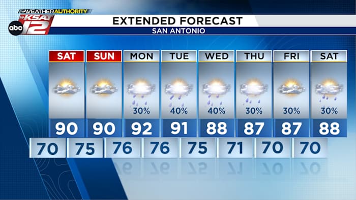
- THIS WEEKEND: Hot & humid with highs near 90
- STRAY STORM: Along Rio Grande this evening, stays west of SA
- NEXT WEEK: Occasional storms, some strong
FORECAST
TONIGHT
If you’re heading out for a Spurs Watch party tonight, the weather looks cooperative. We’ll stay humid & warm in the 80s through the evening, but cooling off a bit after the sun sets. Go Spurs Go!

WEEKEND
Morning cloud cover will last longer both Saturday and Sunday. Drizzle or a few sprinkles are possible Sunday morning. Otherwise, the afternoons will be warm and humid.

ACTIVE NEXT WEEK
The pattern becomes more active by Monday. Isolated storms are expected Monday evening. It’s impossible to know where a storm will pop up, but any storm that does will be capable of severe weather. By Tuesday, a weak front moving into North Texas will raise rain chances.

Again, timing and placement of any storm is impossible to know at this point, but severe weather is a possibility. Beyond that, rain chances stay with us, potentially through Memorial Day weekend.

QUICK WEATHER LINKS
- WATCH LIVE: Doppler Radar
- Hourly and 10-Day Forecast
- Download FREE KSAT Weather Authority App: Up-to-date forecast information and livestreams from trusted local meteorologists.
- KSAT Connect: Share your weather photos.