Cold front brings chance of thunderstorms, hail to San Antonio area overnight

Heavy rain in the city
AlxeyPnferov/Getty Images/iStockphoto
There is a chance for severe thunderstorms to develop around San Antonio and the Hill Country as a cold front moves into the I-35 corridor on Saturday, January 7.
The National Service issued a notice that there is a marginal risk for the storms to develop between 8 p.m. and 4 p.m. for areas “generally near and east of I-35 and I-37.” Although the risk is marginal, NWS said that any severe storms that do develop will be capable of producing locally heavy rainfall, large hail and damaging wind gusts.
The storms are expected to develop both ahead of and after a cold front that is going to drop temperatures down to the mid-40’s to mid-50’s on Sunday morning, January 8.
The precipitation chance will persist throughout the week to Thursday, after which sunny chances are currently forecasted for the weekend.

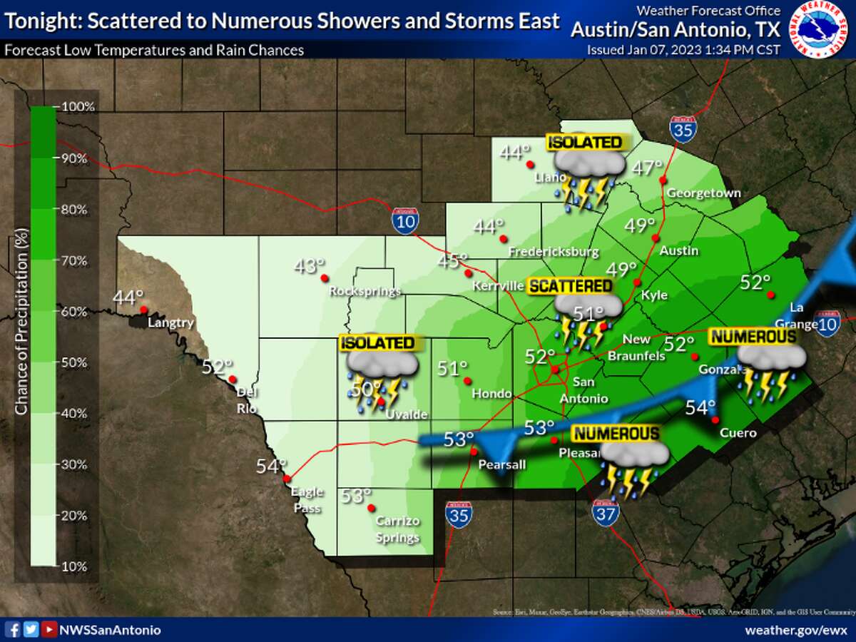
A forecast model of areas that will be affected by possible storms on Saturday, January 7, 2022.
Courtesy of the National Weather Service
A forecast model of areas that will be affected by possible storms on Saturday, January 7, 2022.
Courtesy of the National Weather Service