FORECAST HIGHLIGHTS
- WARM TODAY: Temps near 90, partly cloudy
- COLD FRONT: Arrives just before sunrise on Friday
- FRIDAY: Very windy, temps in the 60s most of the day
- WEEKEND: Chilly mornings, beautiful afternoons
FORECAST
FIND THOSE JACKETS!
🧥 Today will be a good day to dig out your jackets from the closet. You won’t need them this afternoon, but you may want them as early as tomorrow morning and especially during the morning hours on Saturday and Sunday.
TODAY
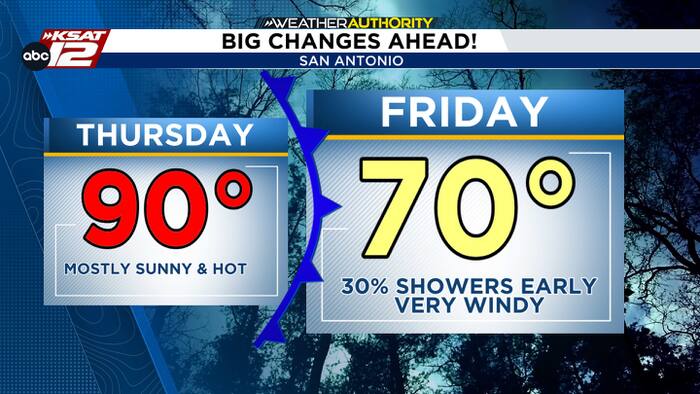
A shower or two is possible this morning, then expect partly cloudy skies and one more hot day before changes arrive. We’ll be near 90 this afternoon.
FRIDAY MORNING: SHOWERS, VERY WINDY
A cold front will slide through just before sunrise on Friday. A broken line of showers will develop along the front and quickly pass through the area. Rain chances sit at 30%, with a window of roughly 3am to 10am. The morning commute could be damp. It’ll also be very windy. Gusts of up to 40 mph out of the north will be possible.


FRIDAY AFTERNOON: STAYING WINDY, CLEARING SKY, COOL
Rain will move out and the sun will return by Friday afternoon. That doesn’t mean it’ll get warm. In fact, highs will struggle to reach 70. Gusty winds will stay in place through the evening.
WEEKEND: COLD MORNINGS, BEAUTIFUL AFTERNOONS
By Saturday morning, San Antonio will see temperatures drop to near 50. Lows dip into the 40s in the Hill Country, with wind chill values falling into the 30s. Sunday morning could be a degree or two cooler. The afternoons are forecast to be beautiful!

QUICK WEATHER LINKS
- WATCH LIVE: Doppler Radar
- Hourly and 10-Day Forecast
- Download FREE KSAT Weather Authority App: Up-to-date forecast information and livestreams from trusted local meteorologists.
- KSAT Connect: Share your weather photos.