FORECAST HIGHLIGHTS
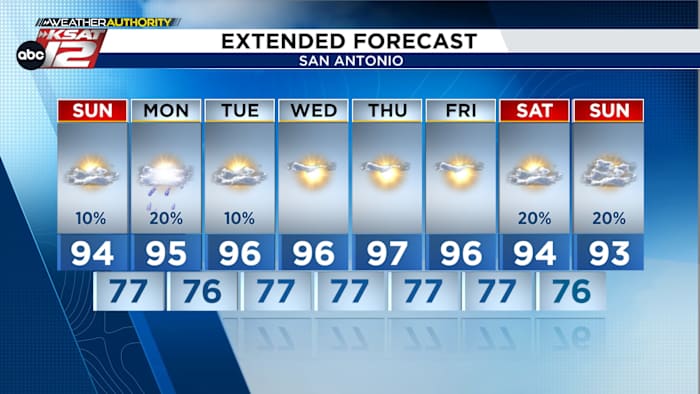
- MONDAY: Slight chance of evening showers and maybe a storm, mainly north of San Antonio.
- TEMPS: Hotter, drier weather with highs climbing into the upper 90s.
- NEXT WEEKEND: Rain and thunderstorm chances return Saturday.
FORECAST
TONIGHT
A small chance for a weakening shower could be possible overnight for areas west of Kerr and Medina counties. Bad weather is unlikely. Once we reach 5 am, conditions will be calm and quiet for everyone to start their Monday.

NEXT CHANCE OF RAIN
The overall weather pattern remains largely unchanged to start the new week. Warm, humid conditions will continue Monday, with another chance for scattered sea breeze showers. The best opportunity for rain and a few thunderstorms will be Monday afternoon and evening, mainly across the Hill Country and along the Interstate 35 corridor. Any storms that develop should remain confined to areas north of Bexar county.

Looking ahead to next weekend, another upper-level disturbance may bring the return of scattered showers and thunderstorms to South-Central Texas on Saturday.
REMAINING SEASONABLE
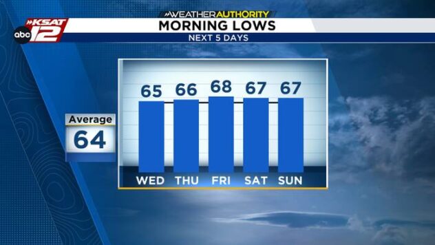
By the middle of the week, high pressure will strengthen over Texas, bringing a stretch of hot and dry weather. Temperatures will gradually edge higher, with afternoon highs reaching the upper 90s by the end of the workweek.

QUICK WEATHER LINKS
- WATCH LIVE: Doppler Radar
- Hourly and 10-Day Forecast
- Download FREE KSAT Weather Authority App: Up-to-date forecast information and livestreams from trusted local meteorologists.
- KSAT Connect: Share your weather photos.