Severe storms bring hail, cool front to San Antonio this week

National Weather Service issues Severe Thunderstorm Watch for parts of Texas, including San Antonio and the Hill Country
Mohammad Sowaid / EyeEm/Getty Images/EyeEm
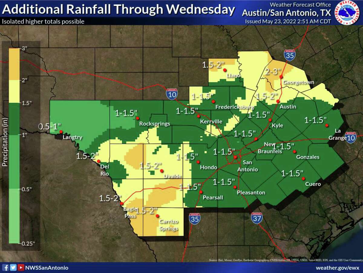
After a stormy weekend, San Antonio can expect additional rainfall with a chance of severe storms during this first part of the week, according to the National Weather Service. Beginning Monday, May 23, storm chances will begin increasing before becoming more likely Tuesday afternoon, May 24, through Wednesday morning, May 25, according to the NWS.
There is also a slight risk of hail, damaging winds, and isolated tornadoes beginning Monday afternoon from a storm moving in from the west this evening. Damaging winds above 70 mph are possible through Wednesday morning, with a low risk of tornadoes through Tuesday night. Hail up to 1.5 inches is thought possible through Monday night, while Tuesday through Wednesday morning carries a chance of hail up to 2.5 inches.
The storms are expected to impact all of South-Central Texas, but the NWS says the rainfall will be beneficial in drought stricken areas. Forecasted rainfall through Wednesday is an average of 1 to 3 inches per day, but minor flooding could occur in isolated areas with higher rainfall.
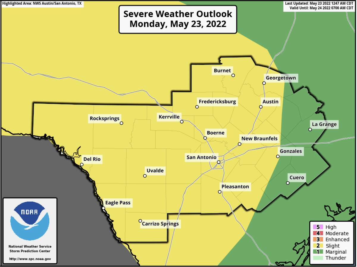
The slight chance for severe weather includes a potential for widespread showers and storms into the overnight hours.
Courtesy of NWS
This week’s storms follow a weekend of inclement weather, which provided San Antonio residents with dazzling displays of lightning. The cooling weather is offering a brief respite from the already scorching weather, which has been unseasonably hot and putting a strain on the power grid.
This month set a weather record for the earliest instance of back-to-back 100-degree days, on May 7 and May 8. We’ve already had more 100 degree days in 2022 than we did in all of 2021. Summer does not officially begin until Memorial Day on May 30, but cooling centers have already been utilized in San Antonio.
The situation report for the San Antonio-Austin area features scattered rain throughout the Hill Country.
Courtesy of NWS
Because of the storms, weather is expected to remain mostly cool this week, with occasional bumps into the ’80s on Tuesday and Thursday, May 26, before getting back into the ’90s on Friday, May 27, just in time for a float trip and a cool beverage.