San Antonio area could see another night of severe weather


May is the peak month for for severe weather season and it shows.
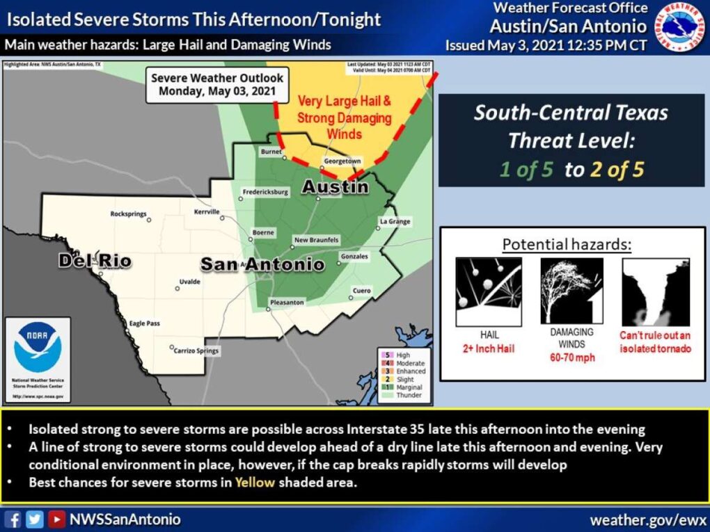
San Antonio could see another round of severe weather Monday evening.
National Weather Service Meteorologist Matthew Brady says the best shot of storms will hit between 5 p.m. and 9 p.m., with storms becoming severe rather quickly if conditions are right.
READ ALSO: Officials issue Ozone Action Day for San Antonio on Monday. Here’s what to do.
According to the NWS, the main threat will be along the I-35 corridor. San Antonio is at a marginal risk for severe storms.
The storms, if severe, could produce very large hail and damaging winds of 60 to 70 mph. An isolated tornado can’t be ruled out, forecasters say.
Ahead of tonight’s weather activity, Gov. Greg Abbott has activated the Texas Division of Emergency Management, with cleanup and rescue resources currently on standby.
“As these severe storms threaten North Texas and the I-35 corridor, I urge Texans in the North and Central portions of our state to take precautions to keep themselves and their loved ones safe,” said Abbott in a release.
Monday’s storms are associated with a dry line arriving late in the afternoon and evening.
The sun returns on Tuesday with a high near 82. Tuesday night will be a little chilly with a low of 59 degrees.