FORECAST HIGHLIGHTS
- BRIEF WARM-UP SATURDAY: 70s
- COLD FRONT SATURDAY NIGHT: 50s and windy Sunday
- FREEZE NEXT WEEK: Hard freeze likely Thursday morning (20s)
FORECAST
💘COLD & DAMP VALENTINE’S NIGHT💘
Grab a coat and plan for damp conditions with drizzle and sprinkles causing wet roadways tonight. This is nuisance moisture more than anything because it’ll only add up to 0.1″ or less.
⛅WARM SATURDAY⛅
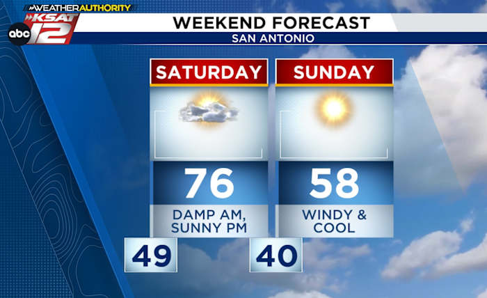
Saturday morning will be damp until the drizzle clears around noon, then a sunny and warm afternoon is expected with highs in the 70s.

⬇COLD FRONT SATURDAY NIGHT, COOLER SUNDAY⬇
A cold front will sweep through around midnight Sunday and will knock down temperatures while kicking up the wind. A chilly morning near 40° will lead to a cool afternoon in the 50s with a gusty north wind. At least we’ll have full sunshine to offset the chill.
🥶NEXT WEEK’S FRONT🥶
The roller coaster weather pattern shows few signs of letting up. A strong front is scheduled for Tuesday night. So, know that Monday and Tuesday will bring a small warm-up, before temperatures plunge on Wednesday morning. Wednesday morning will see temperatures near freezing in San Antonio, along with gusty winds, and a small window for precipitation. At this point, we don’t anticipate any issues with wintry precipitation, but we’ll continue to keep an eye on the situation.
🚨HARD FREEZE THURSDAY MORNING🚨
The bigger story will be a widespread hard freeze Thursday morning, with many areas dipping into the 20s. Teens will be possible in the Hill Country.

QUICK WEATHER LINKS
- WATCH LIVE: Doppler Radar
- Hourly and 10-Day Forecast
- Download FREE KSAT Weather Authority App: Up-to-date forecast information and livestreams from trusted local meteorologists.
- KSAT Connect: Share your weather photos.