FORECAST HIGHLIGHTS
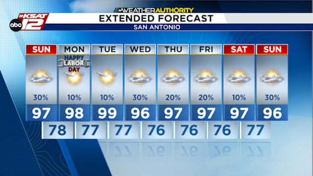
- CONTINUED HOT: Highs upper-90s, heat index near 105°
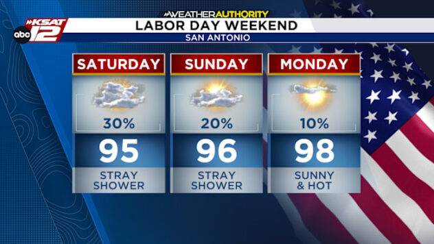
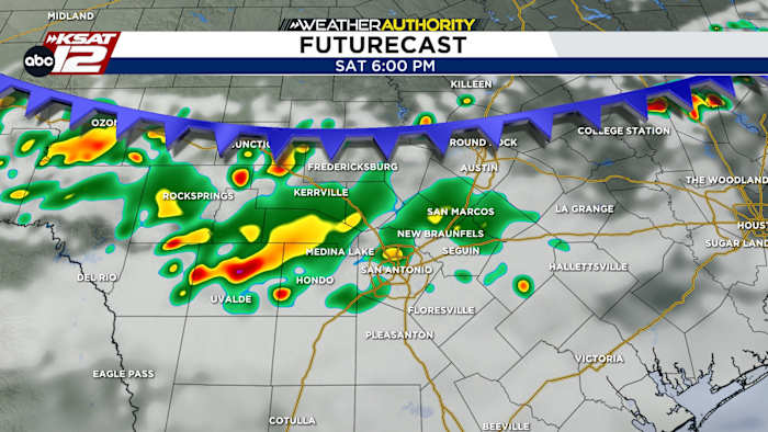
- A FRONT?!: Yes, but no cool down & only a small shot at rain
- NUECES UPDATE: Major flood stage for Three Rivers by Thursday
FORECAST
CONTINUED HOT
Climatologically speaking, we are moving into our hottest time of the year — and it shows. Temperatures will ride around average, if not a degree or two above. A nice amount of humidity will keep heat index values above 103° for several hours each afternoon.

A FRONT THIS WEEKEND?!
Yes, but before you get too excited, know that this front will come limping in and WON’T cool us down. What it MAY do is be just enough to kick up a few showers & storms late Saturday evening. We may also see a few more storms during the day on Sunday.

NUECES UPDATE
Flood waters continue to slowly make their way down the Nueces toward Corpus Christi. Those in Live Oak County around Three Rivers can expect waters to rise today and stay at record flood stage into the weekend.

QUICK WEATHER LINKS
- WATCH LIVE: Doppler Radar
- Hourly and 10-Day Forecast
- Download FREE KSAT Weather Authority App: Up-to-date forecast information and livestreams from trusted local meteorologists.
- KSAT Connect: Share your weather photos.