FORECAST HIGHLIGHTS
- This evening: Warm temperatures persist
- Sunday: Warm and dry conditions roll over
- Next week: Highs move into the upper 90s
FORECAST
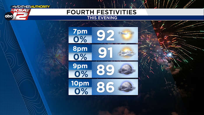
Fourth of July Evening
We only saw one small and quick shower in our area this afternoon, but the chance for any more activity is gone. Conditions will stay dry and warm this evening when you head out to your firework shows. Pack plenty of water and a portable fan if you have one because temperatures won’t fall out of the 90s until those shows begin.

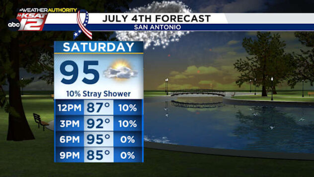
Sunday
Our weather pattern is just going to rewind and play out the same tomorrow. Afternoon temperatures will be close to 95 and 96 degrees and another sea breeze shower could be possible. Weakening showers could move into northern Hill Country areas during the middle of the night. Bad weather is not expected.

Next Week
There’s still a possibility for sea breeze showers Monday and Tuesday. Afterwards, a quiet pattern takes over and temperatures get a little warmer. No triple digits yet, thankfully. Rain showers and potentially a storm could be something to watch next weekend.

QUICK WEATHER LINKS
- WATCH LIVE: Doppler Radar
- Hourly and 10-Day Forecast
- Download FREE KSAT Weather Authority App: Up-to-date forecast information and livestreams from trusted local meteorologists.
- KSAT Connect: Share your weather photos.