Cold front brings chance of showers and thunderstorms to San Antonio
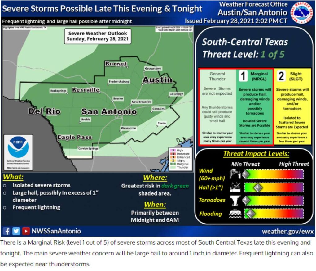
Cold front bringing a marginal risk for severe weather on Sunday night
Courtesy National Weather Service
After a cloudy weekend, a cold front is forecast to move into San Antonio Sunday evening that will bring a drop in temperature and a chance of showers and thunderstorms that will last through Monday afternoon.
The cold front will hit San Antonio this evening with wind gusts near 25 mph and possible thunderstorm activity. These storms are at a marginal risk for severe weather bringing hail up to one inch and damaging winds are low at this time. However, the rain will continue overnight Sunday into Monday.
RELATED: Will the Texas drought affect your bluebonnet photoshoot?
Give yourself extra time for your Monday morning commute as shower and thunderstorms will continue through the afternoon. Winds behind the front will still be breezy at 25 mph and may continue into the evening.
Morning temps will be chilly in the low 40s and afternoon highs will be in the mid 50s.
READ MORE: Texas Parks and Wildlife Department sees large bat fatalities after snowstorm
Teresa Velasco is a digital producer for MySA and the San Antonio Express-News. She has a bachelor’s degree in broadcast meteorology. She uses data provided by the National Center for Atmospheric Research, the National Oceanic and Atmospheric Administration and others for her forecasts.