FORECAST HIGHLIGHTS
- EDOUARD MAKES LANDFALL: Later today, east of Houston
- DIRECT IMPACTS FOR EAST TX: Heavy rainfall for areas along and east of I-45, well east of SA
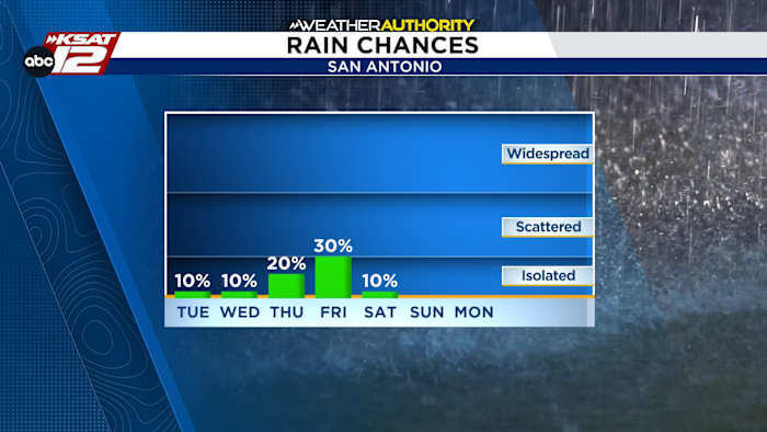
- FEW SHOWERS LATER THIS WEEK: Leftover moisture will move toward SA
FORECAST
EDOUARD MAKES LANDFALL
Tropical Storm Edouard will make landfall later today between Houston and Beaumont. Heavy rainfall will fall in a narrow corridor, as Edouard moves north along I-45. For San Antonio, we stay hot and generally dry. Highs today will be in the upper-90s. It’s not impossible that a few showers move into our eastern counties this afternoon and again on Wednesday.

FORECAST UPDATE
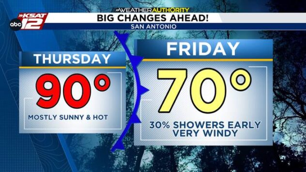
A small change to the forecast occurs later this week. While Edouard will fall apart as it moves north, some of its leftover energy and moisture will eventually dive southwest toward San Antonio. This could be enough to touch off some showers Thursday and Friday. This leftover energy will move and NOT sit, which means it’ll be a passing chance for rain and flooding is not a concern.

HOT LABOR DAY WEEKEND
The forecast is trending hot and dry for Labor Day weekend. Highs will be in the upper-90s, with mostly sunny skies.

QUICK WEATHER LINKS
- WATCH LIVE: Doppler Radar
- Hourly and 10-Day Forecast
- Download FREE KSAT Weather Authority App: Up-to-date forecast information and livestreams from trusted local meteorologists.
- KSAT Connect: Share your weather photos.