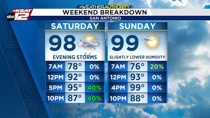
FORECAST HIGHLIGHTS
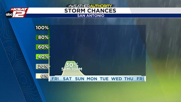
- SATURDAY STORMS: Best chance from 5pm to 10pm
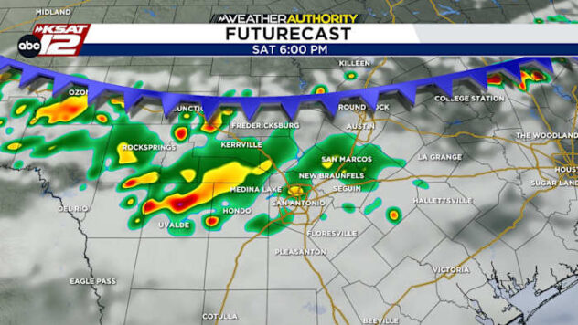
- SEVERE? FLOODING?: Not likely. Gusty winds can’t be ruled out. Average rainfall less than 0.50″, isolated 1″+ possible
- SUNDAY: A few AM lingering showers, rain pushes south
FORECAST
TODAY
Continued hot & humid. Highs near 100°. Heat index 100-105 between 1pm and 7pm.
SATURDAY
The first half of the day will see mostly sunny skies and hot conditions. A weak front will begin to stir up clouds and eventually showers and storms by 3-4pm across the Hill Country. These storms will shift south towards San Antonio roughly between 5pm and 10pm. Severe weather is unlikely, but we can’t rule out gusty winds with any of the stronger storms. Rainfall will generally be less than a half of an inch. An isolated spot or two could see up to an inch. Isolated, brief street flooding is possible.

Our advice: Keep your Saturday evening plans, but be prepared to duck inside for half an our or so, should a storm approach your area. Rain chances for San Antonio sit at 40%

SUNDAY
A few lingering showers are possible early on Sunday. However, rain should push south, leaving us with clearing skies. Humidity will be slightly lower, while temperatures will return to the upper-90s.

QUICK WEATHER LINKS
- WATCH LIVE: Doppler Radar
- Hourly and 10-Day Forecast
- Download FREE KSAT Weather Authority App: Up-to-date forecast information and livestreams from trusted local meteorologists.
- KSAT Connect: Share your weather photos.