FORECAST HIGHLIGHTS
- TONIGHT: Border showers/storms
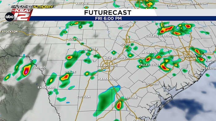
- FRIDAY: Best chance to see rain
- DRIER & HOTTER NEXT WEEK: A drier pattern takes hold
FORECAST
TONIGHT
Upper-level energy is likely to develop showers/storms along the Rio Grande and nearby areas overnight and into the early morning. Just a stray shower is possible elsewhere.
TOMORROW
An upper-level low will scoot closer, enhancing rain chances a bit. Initially, we’ll watch for a few storms coming out of Mexico before sunrise. Then with daytime heating, scattered downpours will pop-up across South Texas. Some will last 15-20 mins, while others could last over an hour. It’s luck of the draw and the “rain lottery” as we like to say.
WEEKEND AND BEYOND
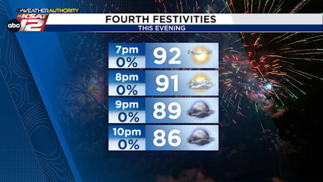
Stray afternoon showers are possible over the weekend, then it’s looking dry and warmer next week.

QUICK WEATHER LINKS
- WATCH LIVE: Doppler Radar
- Hourly and 10-Day Forecast
- Download FREE KSAT Weather Authority App: Up-to-date forecast information and livestreams from trusted local meteorologists.
- KSAT Connect: Share your weather photos.