FORECAST HIGHLIGHTS
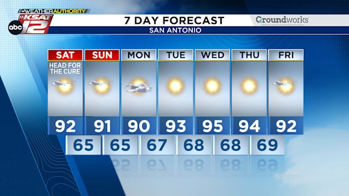
- MORE OF THE SAME: 60s near sunrise, 90S in the afternoon
- DRY AIR STICKS AROUND: Thanks to a high pressure system overhead.
- NO RAIN: Staying dry for *at least* the next 7 to 10 days
- TROPICS: Soon-to-be Imelda will impact east Atlantic coast
FORECAST
If you’ve been enjoying those crisp mornings and summer-like afternoons, you’re in luck. San Antonio and the Hill Country will continue to see cool mornings and warm afternoons through the coming week.

Otherwise, it’s going to be a hot, dry stretch in drought-weary South Central Texas…
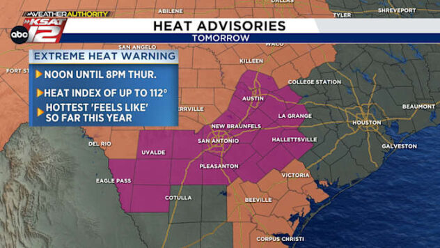
THIS WEEKEND
After starting with our coolest morning since May 12, Saturday will quickly become hot with a high in the low-90s. Expect similar weather Sunday. Thankfully, humidity will stay pleasantly low even during the peak heat of the day.
TROPICS

Hurricane Humberto is expected to strengthen into a category 5 hurricane this weekend, and could impact Bermuda by the middle of next week.
Meanwhile, soon-to-be named storm Imelda is the storm that may have the biggest impact on the United States. It could strengthen into a hurricane and bring a flood threat to the Carolinas. We’ll keep you posted.
THIS WEEK
Those of us hoping for rain will have to wait a while. There’s not a hint of precipitation through at least the next 7 to 10 days. That’s not good news for our multi-year drought.

QUICK WEATHER LINKS
- WATCH LIVE: Doppler Radar
- Hourly and 10-Day Forecast
- Download FREE KSAT Weather Authority App: Up-to-date forecast information and livestreams from trusted local meteorologists.
- KSAT Connect: Share your weather photos.