WATCH LIVE RADAR IN PLAYER ABOVE
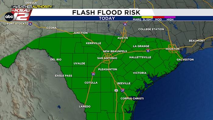
FORECAST HIGHLIGHTS
- SAN ANTONIO RAIN AMOUNTS: If you get a storm, you could see 1-2″. Most will see less.
- IMPACT: Minor street flooding and closed low-water crossings
- THIS WEEK: Rain-free with heat and low humidity
FORECAST
SUNDAY

Many neighborhoods have seen a decent amount of rain today. Check out radar in the video above before heading out this afternoon. If you happen upon a lot of water on the road, remember: TURN AROUND, DON’T DROWN.
With extra cloud cover and times of rain for some, the high around San Antonio will be in the low- to mid-80s. That’s the coolest we’ve been since the July 4th floods.

LOOKING AHEAD
It’s going to be a rain-free and hot week. But, here’s the thing: Even though temps will be in the upper-90s, low humidity will make it feel *okay* in the afternoons.

QUICK WEATHER LINKS
- WATCH LIVE: Doppler Radar
- Hourly and 10-Day Forecast
- Download FREE KSAT Weather Authority App: Up-to-date forecast information and livestreams from trusted local meteorologists.