FORECAST HIGHLIGHTS
- THIS WEEK: Hot and muggy conditions ramp up, with heat indices reaching or surpassing 100 degrees.
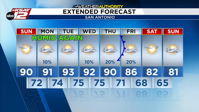
- RAIN CHANCES: Isolated to scattered showers possible Monday and at the end of the week.
- PATTERN CHANGE?: A cold front could approach South Texas, but its timing, strength and rainfall potential remain uncertain.
FORECAST
HOT AND INCREASINGLY HUMID
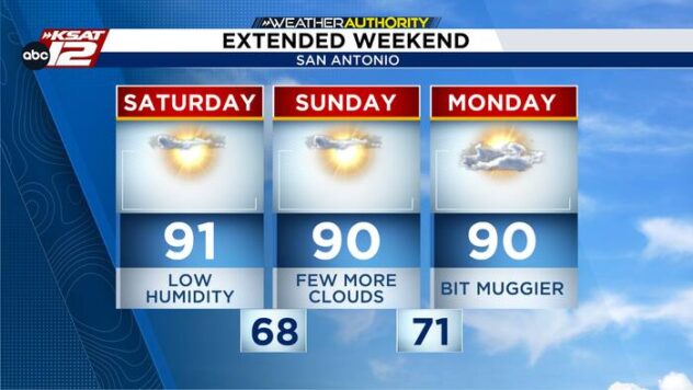
You’ll definitely notice a shift by Monday morning as lows climb into the upper 60s and lower 70s. Monday will remain hot, and heat indices will reach the mid-90s to near 100.

Isolated showers or thunderstorms are possible, primarily across the Coastal Plains and the eastern I-35 corridor, though most areas will stay dry. Through midweek, isolated storm chances will persist across the Coastal Plains, with the sea breeze occasionally pushing activity inland toward the I-35 corridor.
RAIN CHANCES AND A POSSIBLE COLD FRONT?
Late week, an upper-level disturbance could bring a cold front to South Texas, though the intensity and exact timing remain uncertain. Expect hot, humid conditions early this week with limited rain chances ahead of the potential front.

QUICK WEATHER LINKS
- WATCH LIVE: Doppler Radar
- Hourly and 10-Day Forecast
- Download FREE KSAT Weather Authority App: Up-to-date forecast information and livestreams from trusted local meteorologists.
- KSAT Connect: Share your weather photos.