FORECAST HIGHLIGHTS
- RAIN: Hit-or-miss showers are done for now.
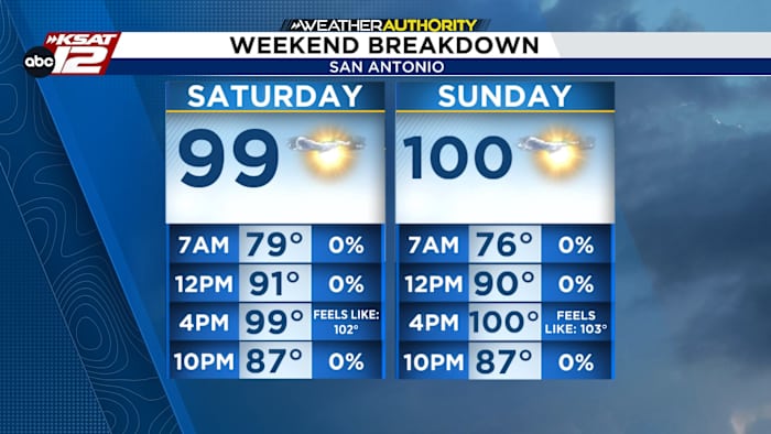
- WEEKEND: Hot and dry, with highs near 100 degrees.
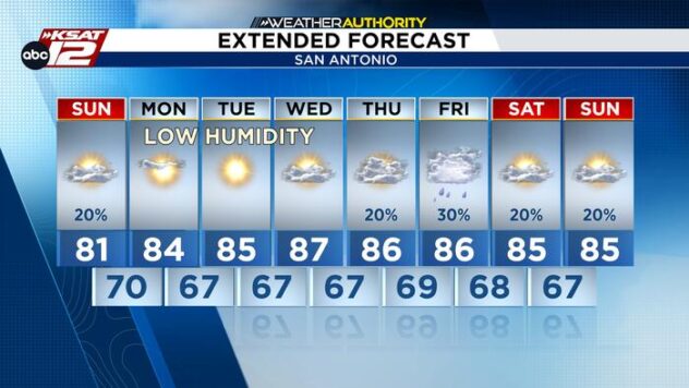
- NEXT WEEK: A stretch of triple-digit temperatures is expected.
- RAIN RETURNS? Small rain chances may return by next weekend, but confidence is low.
FORECAST
Friday’s showers are over, and a few areas picked up around 0.25 to 0.5 inches of rain, while heavier totals near 1.5 inches were reported farther east. For San Antonio and most of the I-35 corridor, rainfall was much lighter.

WEEKEND
The weekend will be dry and hot, with highs in the mid-90s to near 100 degrees both days. Overnight lows will stay in the 70s.
It’ll be great pool and splashpad weather, but afternoon heat will be intense. A few spots along the Coastal Plains could see heat index values approach 108 degrees.

HEATING UP
The heat really ramps up next week. A strong ridge of high pressure will bring a stretch of triple-digit temperatures, with the potential for some of the hottest weather of the year so far.
San Antonio International Airport has recorded just three 100-degree days this year, though other parts of the area have seen more.

For now, the forecast stays mostly dry through next week. There are some early signs that small rain chances could return by next weekend, but that’s still uncertain.

QUICK WEATHER LINKS
- WATCH LIVE: Doppler Radar
- Hourly and 10-Day Forecast
- Download FREE KSAT Weather Authority App: Up-to-date forecast information and livestreams from trusted local meteorologists.
- KSAT Connect: Share your weather photos.