FORECAST HIGHLIGHTS
- RAINFALL TOTALS: Heaviest rain totaled near 4″ over the past 24 hours.
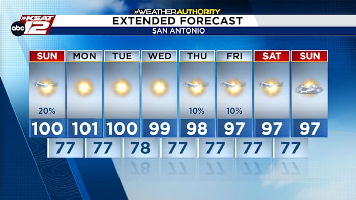
- TODAY: Highs returning to the upper 90s and near 100 degrees.
- THIS WEEK: Hot, mostly sunny, and rain chances remain limited.
FORECAST
RAINFALL TOTALS
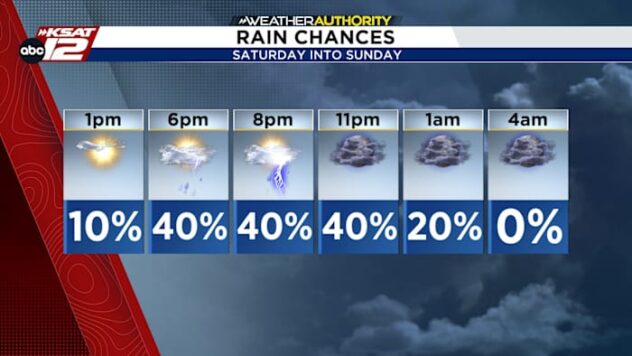
Saturday’s and Sunday morning’s storms brought heavy rain to the Hill Country and Rio Grande Plains. Over 3 inches were recorded in parts of Edwards, Real, Uvalde, and Kinney counties. Accumulations in La Salle county were close to 4″.

SAHARAN DUST
Dust looks to make a return this week between Tuesday and Wednesday. Coastal areas will see more dust than the rest of us on Wednesday, but we’ll have the haze clear up by Thursday.

HOT & DRY
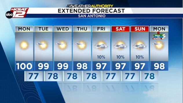
A hot, dry pattern returns as high pressure builds, bringing sunshine and highs near 100°F next week. Aside from slight humidity increases and isolated coastal showers mid-week, widespread rain is not expected.

QUICK WEATHER LINKS
- WATCH LIVE: Doppler Radar
- Hourly and 10-Day Forecast
- Download FREE KSAT Weather Authority App: Up-to-date forecast information and livestreams from trusted local meteorologists.
- KSAT Connect: Share your weather photos.