FORECAST HIGHLIGHTS
- MORE HEAT (OF COURSE): Temps near 100° through foreseeable future
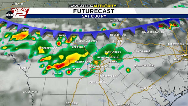
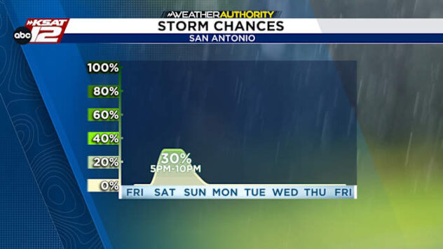
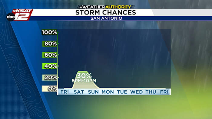
- SATURDAY STORMS: Small window late Saturday for mainly non-severe storms
- QUIET TROPICS: El Nino helps to keep the Atlantic quiet
FORECAST
DOG DAYS OF SUMMER UNDERWAY
Now through mid-August, San Antonio averages it highest daytime temperatures. Right on cue, we’ll experience our hottest stretch so far this year. Take your pick: 98°, 99°, or 100° — that’s what you can expect for a daytime high through the foreseeable future. Heat index values will reach 100-105° for a few hours each afternoon.

SATURDAY EVENING STORMS
The one small window of change arrives for a few hours Saturday evening (roughly 5-10pm). A weak front or outflow boundary will move south into the area, touching off a few showers or storms. We expect most of this activity to be non-severe, but a strong storm or two can’t be ruled out. The rain chance is 30%.

EL NINO UPDATE
El Nino is now in fully underway. In fact, the Climate Prediction Center is calling for a 97% chance of El Nino persisting into early 2027. What does that mean for us? Not much, for now. We will see a fairly quiet Atlantic hurricane season, but the bigger impacts likely arrive this Fall and Winter. While not a guarantee, it often means more impactful weather systems for South Texas.

QUICK WEATHER LINKS
- WATCH LIVE: Doppler Radar
- Hourly and 10-Day Forecast
- Download FREE KSAT Weather Authority App: Up-to-date forecast information and livestreams from trusted local meteorologists.
- KSAT Connect: Share your weather photos.