FORECAST HIGHLIGHTS
- TODAY: Mostly sunny, hot, and rain-free with highs in the upper 90s to near 102°
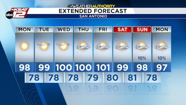
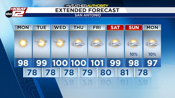
- MIDWEEK: Widespread triple-digit temperatures become more common
- HEAT INDEX: Afternoon “feels-like” temperatures ranging from 101° to 107° today, climbing closer to 110° later this week
- RAIN CHANCES: Virtually zero through at least Friday
FORECAST
TODAY
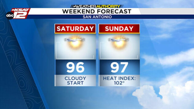
A strong upper-level high remains parked over Texas, keeping hot and dry weather in place across South-Central Texas. Temperatures will climb a degree or two warmer than yesterday, reaching the upper 90s to low 100s this afternoon, with heat index values ranging from 101° to 107°. Skies will stay mostly sunny with only a few passing high clouds, and no rain is expected.

TURNING UP THE HEAT
The hottest weather of the week is expected late in July’s final week, with afternoon temperatures rising into the 100°–105° range by Thursday and Friday as a strong ridge of high pressure strengthens. Combined with humidity, heat index values may reach 105°–110°, especially in lower elevations and the Coastal Plains, and heat-related advisories could be issued if confidence in these higher values continues to increase.

EXTENDED OUTLOOK
Expect sunshine, dry conditions, and triple-digit heat through Friday. A shift in the upper-level ridge may bring scattered rain and cooler temperatures to South-Central Texas by late this weekend.

QUICK WEATHER LINKS
- WATCH LIVE: Doppler Radar
- Hourly and 10-Day Forecast
- Download FREE KSAT Weather Authority App: Up-to-date forecast information and livestreams from trusted local meteorologists.
- KSAT Connect: Share your weather photos.