FORECAST HIGHLIGHTS
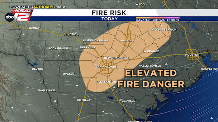
- FIRE RISK: Elevated. Use caution!
- MONDAY MORNING: 50s. Coolest since May
- THIS WEEK: Still warm, near-90°. Small rain chance Friday
FORECAST
With windy and dry weather, fire danger is high today. Please use caution. Here are some helpful tips to avoid creating and spreading grassfires…
MONDAY MORNING
With calm winds and clear skies, temperatures are expected to plummet Sunday night. By Monday morning, we’ll likely be in the 50s. That’s the coolest we’ve been since May.

THIS WEEK
Upper-level high quickly takes hold across our area for much of the week. But what we’re watch is for the chance of a stray shower. Several global models are teasing that we may see our next decent shot of rain mainly across our eastern half when the next front moves through Friday.

Cool weather will be short-lived. We’ll be near 90° each day this week. We’ll keep you posted!

QUICK WEATHER LINKS
- WATCH LIVE: Doppler Radar
- Hourly and 10-Day Forecast
- Download FREE KSAT Weather Authority App: Up-to-date forecast information and livestreams from trusted local meteorologists.
- KSAT Connect: Share your weather photos.