FORECAST HIGHLIGHTS
- SUNDAY: Damp morning with patchy fog & drizzle, afternoon 50s and breezy
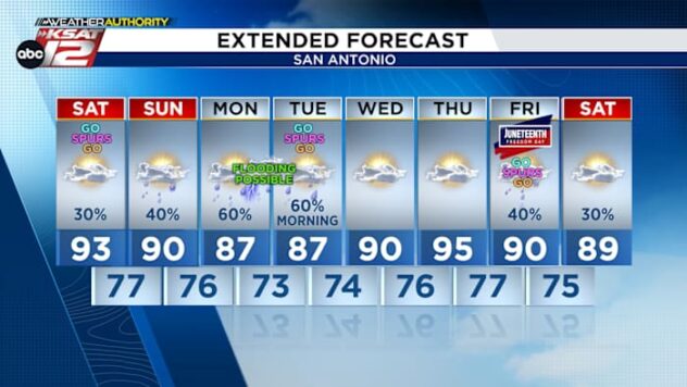
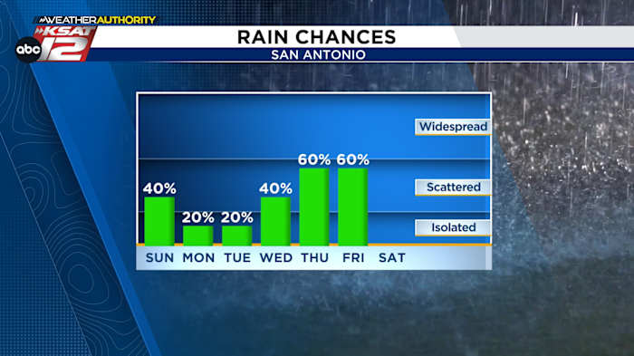
- RAIN CHANCES NEXT WEEK: Looking more promising, best chances Thursday and Friday
FORECAST
Happy weekend!
SUNDAY
Patchy drizzle and fog will develop overnight tonight, leading to a damp Sunday morning. Temperatures will aim for the mid-50s by late in the morning before a weak cool front arrives.
The front will allow temperatures to gradually fall through the 50s and eventually into the 40s by Sunday afternoon and evening.
It will also become breezy, as well, with wind gusts upwards of 20 miles per hour.

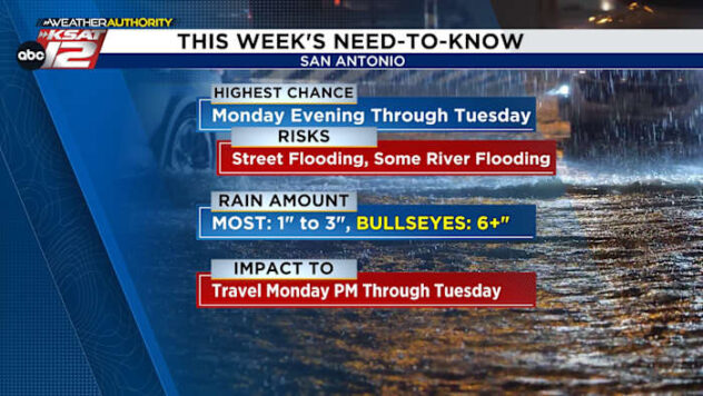
RAIN CHANCES NEXT WEEK
The cloud cover is generally here to stay through much of the upcoming week. While a few isolated showers can’t be ruled out Monday and Tuesday (20%), the better rain chances arrive by Thursday and Friday as an area of low pressure develops out west and gradually moves towards the Lone Star State.

Expect periodic dampness during this timeframe, and know that while these numbers will need to be fine-tuned in the days ahead, it’s currently looking like 1 to 3 inches of rain will be possible for parts of our area by the time all is said and done.
We’ll keep you posted. Until then, have a great weekend!

QUICK WEATHER LINKS
- WATCH LIVE: Doppler Radar
- Hourly and 10-Day Forecast
- Download FREE KSAT Weather Authority App: Up-to-date forecast information and livestreams from trusted local meteorologists.
- KSAT Connect: Share your weather photos.