San Antonio’s new greenway trails offer a view of the city we otherwise might zoom past
- Bill Baird
- The Howard Peak Greenway system offers a way for San Antonians to experience their city on foot.
Inspired by the city’s network of greenway trails, I set out to do what seemed illogical, impossible or just plain idiotic: circumnavigating San Antonio on foot, utilizing the newly christened Howard Peak Greenway system.
Where the trails ended, I’d continue along creek beds, roadsides, vacant lots and railroad tracks.
Has the perimeter of SA ever been thru hiked? It seemed I’d be among the first, which made the trek an irresistible target, and just crazy enough to be interesting. Or perhaps just crazy.
“You’re doing what?” people responded to my plan, as if I’d announced an intention to eat my shoes. “Why not bike, drive or just sit and chill at home?”
The reasons to walk are many. It’s meditative, your mind unwinds, your anxiety ebbs and you feel a grateful reverence. In the words of the beat poet Gary Snyder, “Walking is the great adventure, the first meditation, a practice of heartiness and soul primary to humankind. Walking is the exact balance between spirit and humility.”
That may sound a bit lofty. Truth is, I don’t really know San Antonio, having recently moved back here after a 20-year absence. In my experience, you understand an area best by foot. Walking forces you to consider the areas we normally zoom past in our cars.
The roar of the traffic
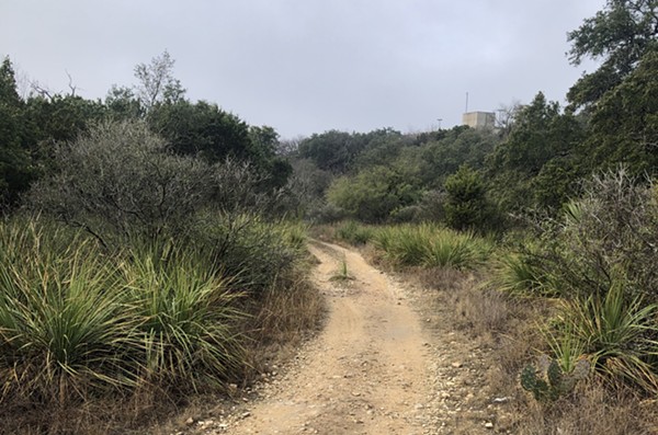
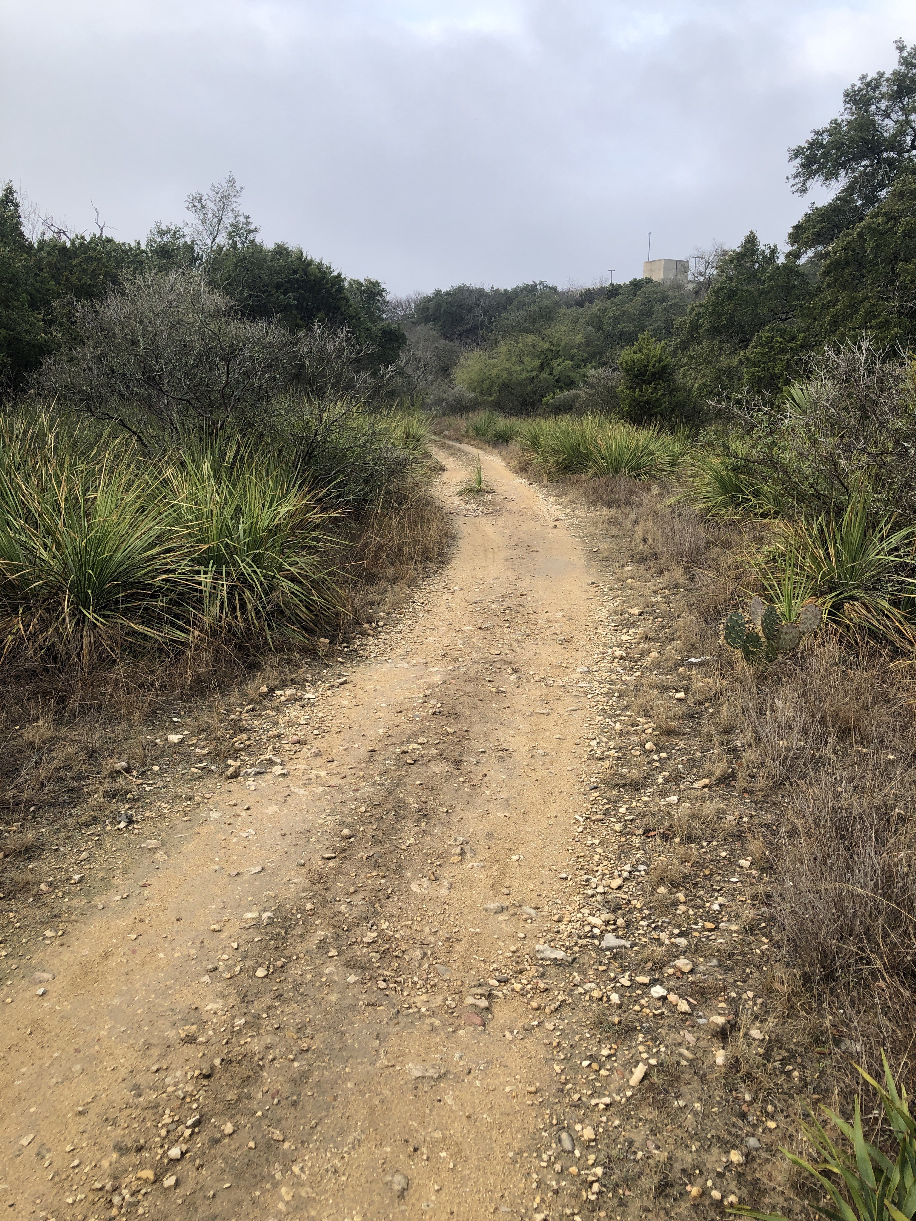
My journey began by hiking the entirety of Leon Creek. Leon Valley was once the outer edge of the Western frontier — the first watering stop along the old San Antonio-to-El Paso stage road.
“There were indeed many mountain lions in the area,” Carol Poss, Leon Valley’s unofficial historian, told me before I set out. She grew up on a dairy farm there. “The mountain lion is the official seal of Leon Valley.”
Indeed, the word “leon” is Spanish for lion. While I saw no mountain lions on my trek, I did spot innumerable deer.
The trail began behind La Cantera Parkway, along the edge of a shopping mall. Duck down behind the JC Penney there and you’ve entered a different world: old rock quarries, caves, cliffs and native plants galore. Those treasures, however, aren’t visible from the street.
The trail passed under familiar roads — Vance Jackson Road, Huebner Road, Bandera Road — the roar of the mountain lion now replaced by the roar of traffic. Lost in thought, I wondered the origin of those street names. Turns out, Huebner Road was named for Joseph Huebner, an early Leon Valley resident, whose home was a stagecoach stop. It’s now a public park and spot on local ghost tours.
The creek will remain
Around the sixth mile of my walk, I descended from the Balcones escarpment’s rocky ledges to the alluvial soils of the Blackland prairie. The stunning native vegetation along the way changed as well, with trees whose Spanish names should be familiar to San Antonians – the olmos (cedar elm), alamo (cottonwood), huisache and roble (oak).
As Leon Creek passes through O.P. Schnabel Park, chalky cliffs rise from its banks. I left the official pathway, hiking the creek bed itself, lost in a reverie. The parking lots and strip malls up above, I realized, eventually will disappear. Might take a hundred years, might take a thousand, but they will one day — poof — vanish, while the creek will live on, still carving its meandering path across Bexar County.
My head drifted into the clouds, and my reveries were such that I missed the Military Road trailhead, continuing downstream into unfamiliar territory. No trails there. I crawled under barbed wire, dodged cars, skirted a water-treatment plant, sprinted across private property and stumbled my way to Martinez Park’s Arvil trailhead 22 miles down.
‘Exhilarating pile of garbage’
From Martinez Park, I followed the creek bed until Lackland AFB, where I skirted the base’s fence-line along Medina Base Road, and eventually summited the wonderful hilltop at Pearsall Park. The giant, grassy hill seemed, well, a bit out of place.
After some online sleuthing, I realized the hill was a rehabbed landfill, “the most exhilarating pile of garbage in the area,” reporter Jeremy Gerlach once wrote in the Express-News. Despite its origins, Pearsall Park proved to be a cool experience that offered a great view of downtown. Recommended.
At that point, I could follow Leon Creek again — until the trail’s end, anyway.
I ducked under a bridge and emerged in some untouched meadows, eventually crossing multiple highways and traversing many miles of farm roads. Despite the city’s bold claims of a connected series of trails, there is a huge gap in Southwest San Antonio. This part of town sorely needs trails, greenways and parks, not just more housing developments.
The final mile down to the Medina River ran along Highway 16. My legs were throbbing, my feet covered in blisters, my hair wild, my smile wide and my eyes opened to the sheer size of the city to which I have returned. I’d hiked 37 miles in two days across the western edge of the city.
Our city is blessed with wonderful parks, ancient creekbeds, blooming native plants, sun-scorched rocks, fascinating frontier history, colonial ruins and ample space to walk alone with your thoughts. You can’t grasp it from the window of your car, though, and it can’t be gleaned second hand. To experience all it has to offer, you have to get out there and find it for yourself — beneath the freeways, behind the parking lots.
It’s your city — go find it.
Stay on top of San Antonio news and views. Sign up for our Weekly Headlines Newsletter.