Cold front bringing chance of strong to severe thunderstorms early Sunday east of San Antonio
-
Photo: Courtesy National Weather Service
Photo: Courtesy National Weather Service
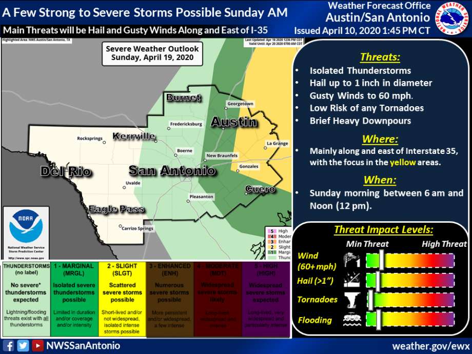
Residents in areas near San Antonio along and east of Interstate 35 may awaken to thunderstorms Sunday morning, according to the National Weather Service.
A Pacific cold front is moving across the area overnight but forecasters say the main area of concern will most likely impact Williamson, Lee, Fayette and Lavaca counties, and likely to produce showers and possibly thunderstorms.
Although, the National Weather Service reports the chances of severe storms remain low, and rain totals are estimated to be less than 0.25 inches.
Isolated wind gusts could reach up to 60 mph with a chance of hail the size of a quarter.
The National Weather Service predicts the storms will occur between 6 a.m. and noon.